
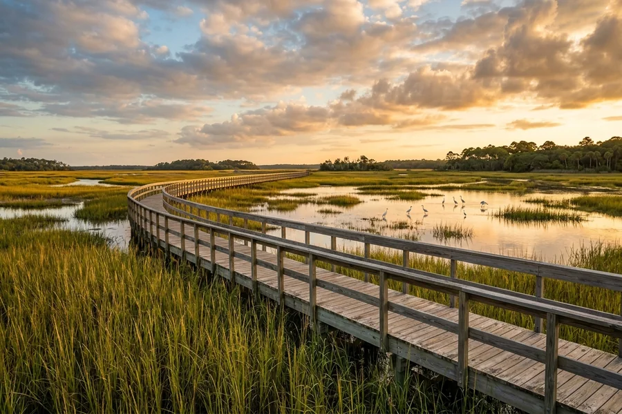
Kiawah Island sits about forty minutes southwest of downtown Charleston, South Carolina. It stretches roughly ten miles along the Atlantic coast and averages a mile and a half across at its widest point.
That compact footprint shapes the whole visit. Nothing is far away, but each corner of the island has its own character, from quiet marshland in the west to wide, flat beaches in the east.
How the Island Is Laid Out
The main road, Kiawah Island Parkway, runs the length of the island from the gatehouse to Beachwalker Park at the western tip. Side roads branch off toward the beach and toward the Kiawah River.
Driving end to end at the posted twenty-five mile per hour limit takes about twenty-five minutes. Visitors who want visitor resources for Kiawah Island often start with a simple map and plan around a few anchor points rather than hopping back and forth.
The island splits loosely into east, central, and west sections. The east holds the resort village and the Ocean Course. The center is residential and quieter. The west ends at a public county park with its own beach and parking.
Getting Through the Gate
Access beyond the gatehouse is limited to residents, renters with a confirmed stay, day guests of residents, and resort visitors with a reservation. Day trippers without a connection use Beachwalker Park at the far west end, which anyone can enter for a modest parking fee.
Beach Access Points and Lengths
Kiawah’s beach is roughly ten miles long and averages a hundred to two hundred feet of walkable sand at low tide. Hard-packed sections near the shoreline are firm enough for bicycles and strollers.
More than two dozen numbered boardwalks cross the dunes, spaced every few hundred yards. Each sign shows a boardwalk number, which doubles as an orientation reference if you lose track of where you parked.
Beachwalker Park at the west end offers the easiest public entry, with roughly three hundred parking spaces, outdoor showers, and summer lifeguards. The current often runs stronger near the Kiawah River inlet, so swimmers tend to stay a few hundred yards east of the point.
Tides and Timing
Low tide exposes wide, firm sand ideal for shelling, biking, and long walks. High tide narrows the beach to twenty or thirty feet in some stretches. Charleston tide tables apply directly to Kiawah, and swings of five to six feet are typical.
Trail Lengths and Where They Lead
The island is laced with about thirty miles of paved and crushed-shell paths. Most run parallel to the parkway or follow the lagoons behind the beach.
A full east-to-west route from the resort village to Beachwalker Park covers roughly ten miles one way. Riders typically break it into loops of three to five miles, using the lagoons and nature preserves as rest stops.
The Marsh Island Park loop is a popular introduction. It covers about a mile and a half of flat crushed shell and ends at an elevated boardwalk over tidal marsh, where egrets, herons, and the occasional alligator are easy to spot.
Night Hours and Lighting
Kiawah has strict dark-sky rules to protect nesting sea turtles from May through October. Most paths are unlit after sunset. A small bike headlight is useful for anyone riding back after dinner.
Distances to Nearby Points of Interest
Freshfields Village, the shopping and dining hub just outside the gate, is about ten minutes by car from the parkway. It has a grocery store, a pharmacy, and a handful of restaurants.
Downtown Charleston is roughly twenty-two miles northeast and typically forty to fifty minutes by car, depending on bridge traffic. Charleston International Airport is about forty-five minutes to an hour, mainly on Interstate 526.
Johns Island, with its farmland and the famous Angel Oak tree, sits five to ten miles inland. The oak itself is a quick fifteen-minute drive from the Kiawah gate and makes a popular half-day outing.
Planning Around Island Scale
Because the island is small and the speed limit is low, the clock matters more than the odometer. A short errand to Freshfields can take forty-five minutes round trip once you factor in the gatehouse and parking.
Grouping activities geographically helps. A morning on the east-end beach pairs naturally with lunch at the resort village, while a west-end afternoon fits well with a late walk at Beachwalker Park and a stop at Freshfields on the drive back toward Charleston.

Hi, I’m Tony — a passionate blogger with over 3 years of experience in writing informative and accurate content. I specialize in sharing practical insights on sizes, measurements, and spatial guides to help readers make confident decisions. Through DimensionsPoint.com, I aim to simplify complex data into easy-to-understand content that’s reliable, useful, and SEO-friendly.
When I’m not writing, I’m researching the latest trends in measurement standards and user needs to keep my content relevant and up to date.